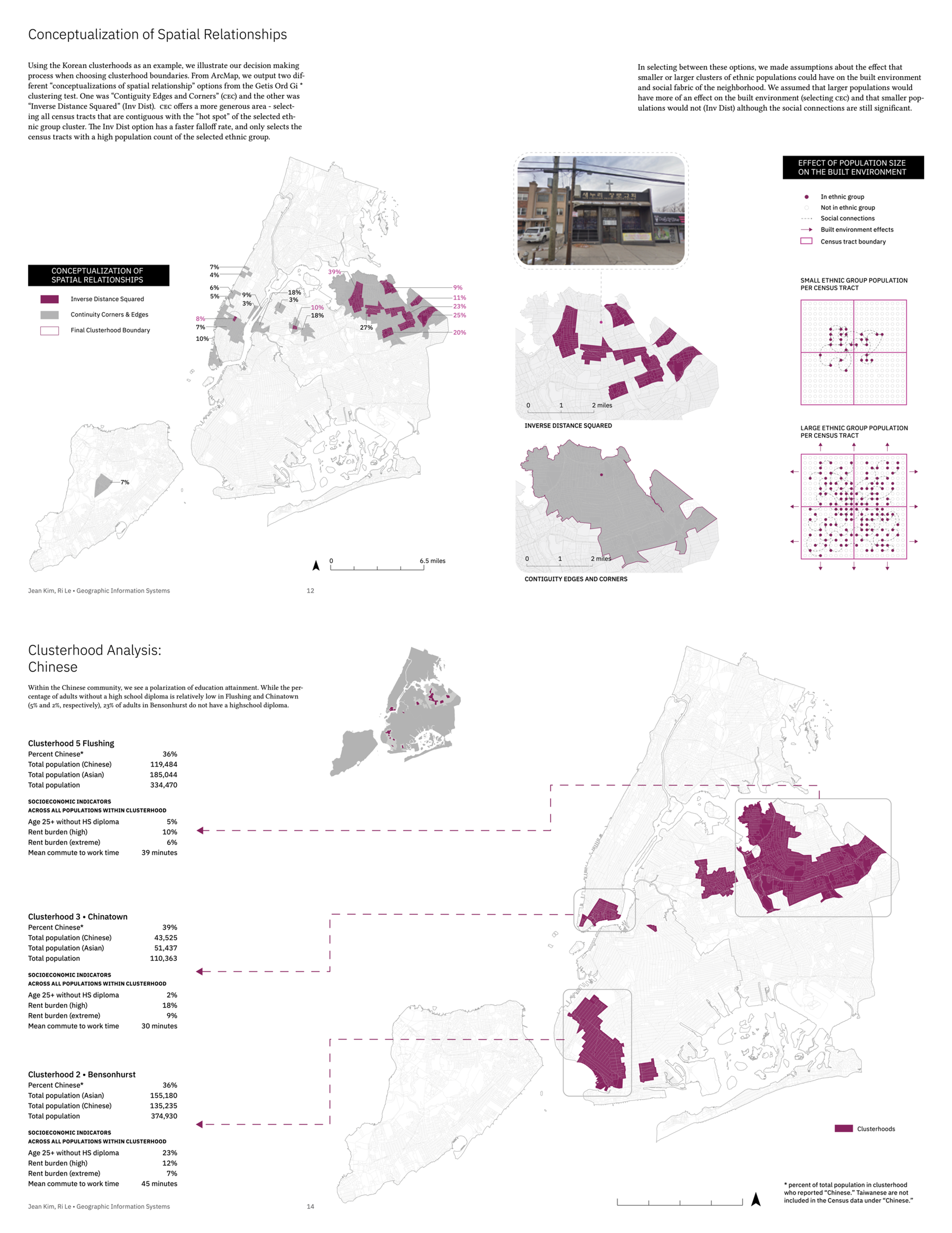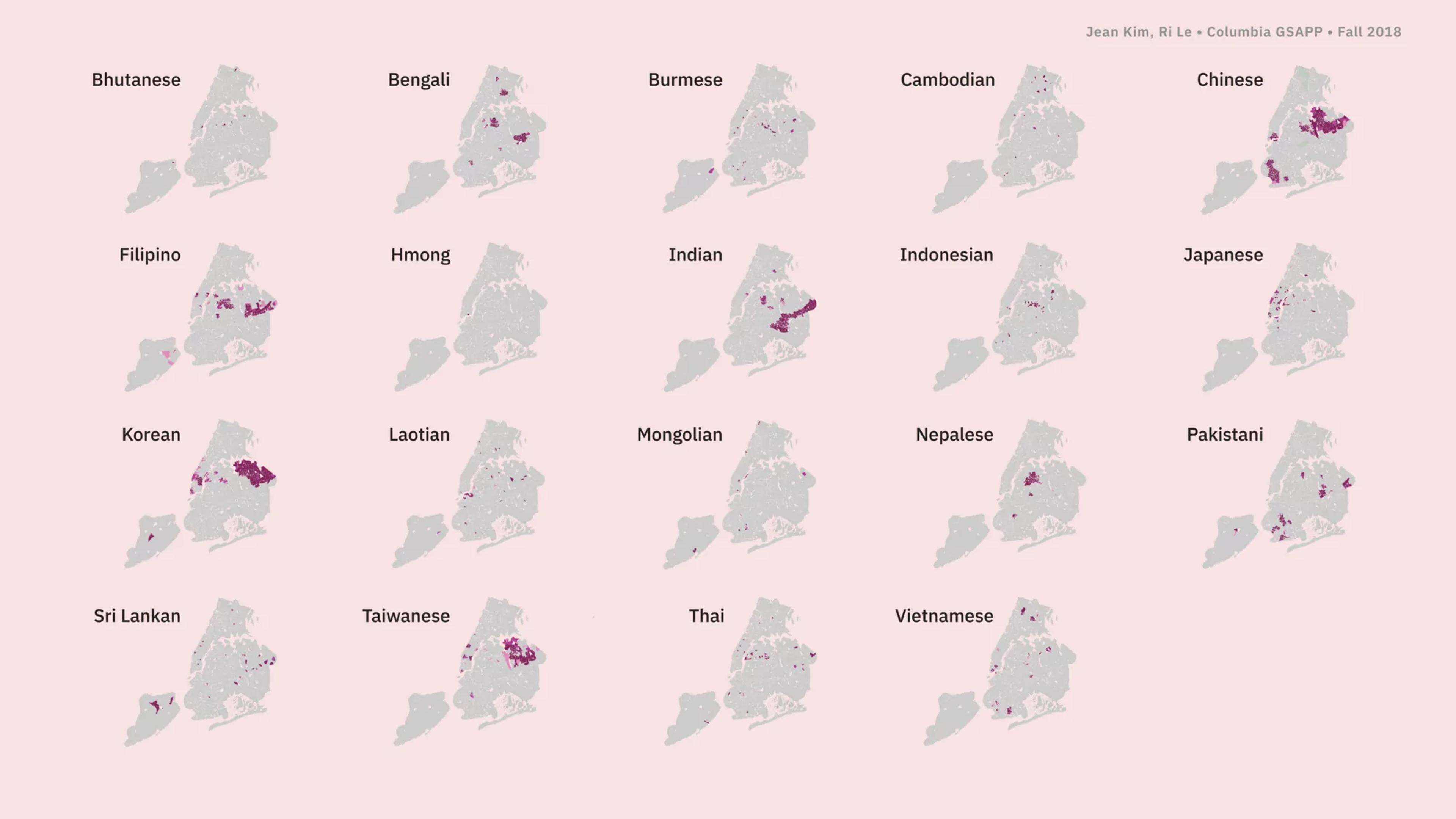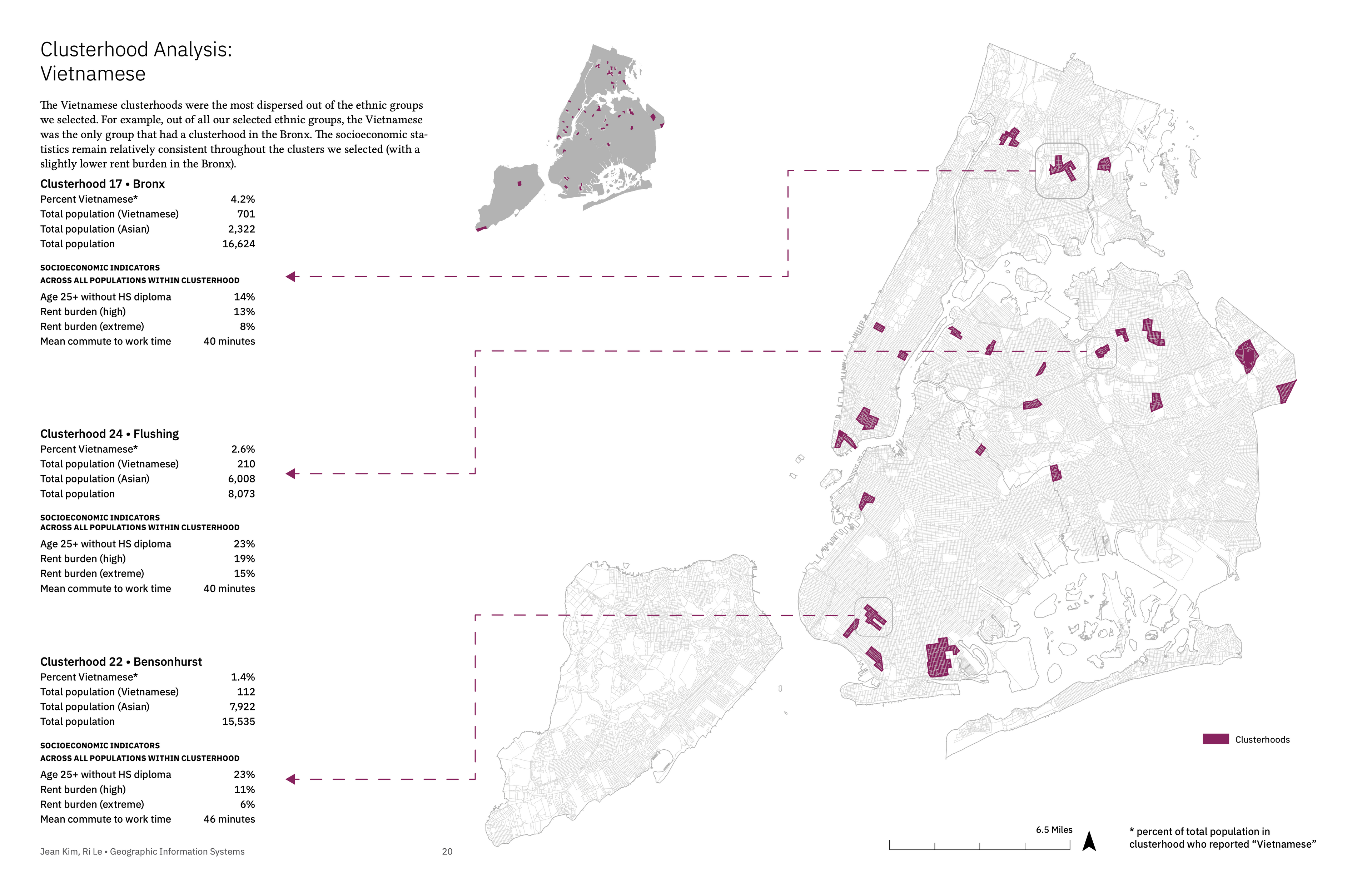
Does disaggregated data map the spatial distribution/clustering of distinct ethnic immigrant communities? What type of socioeconomic patterns do these hypothetical clusterhood units reveal?
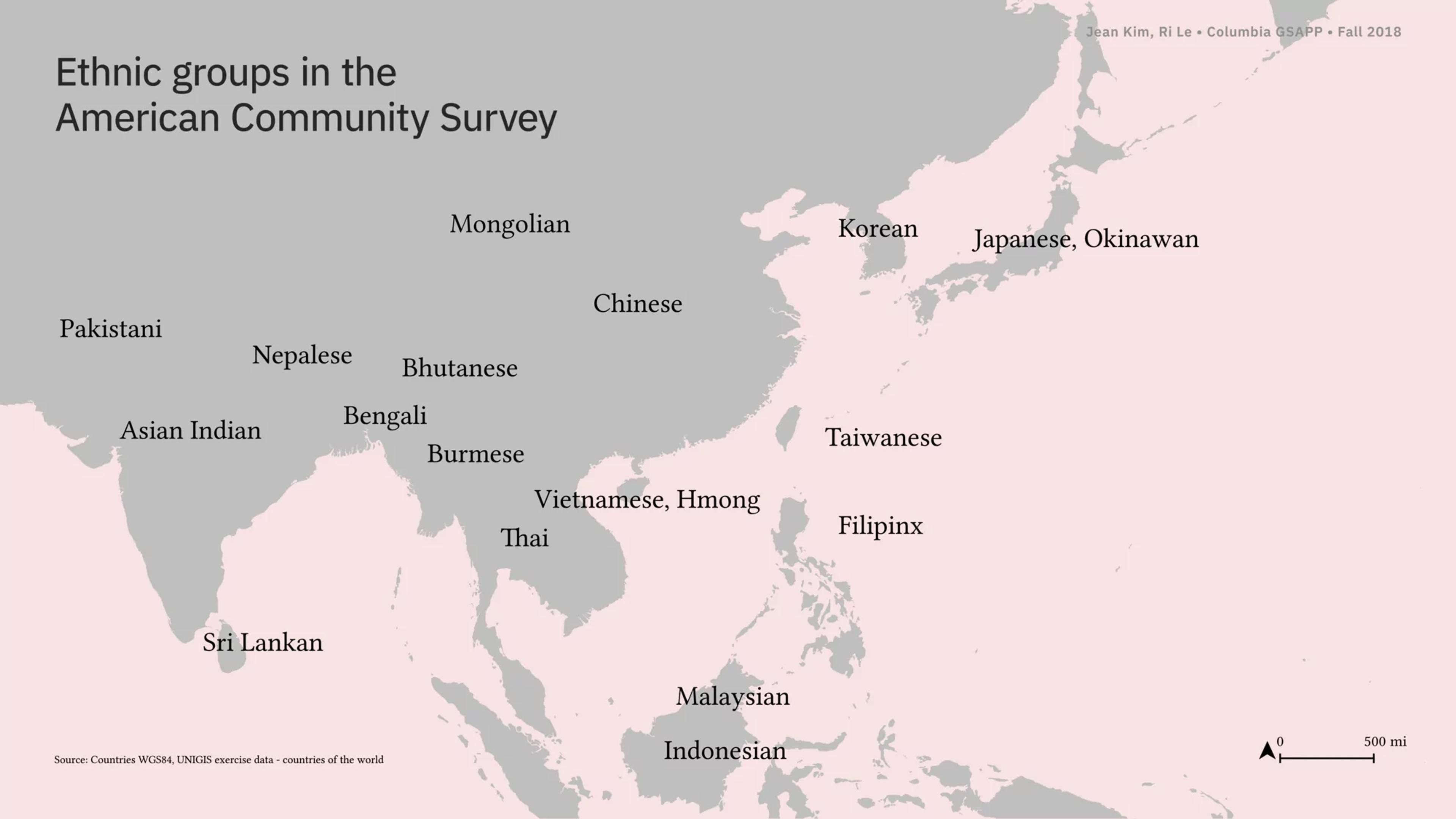
Upon examination of our results, we found that certain ethnic groups had higher percentages of socioeconomic risk than others (confirming our initial hypothesis that the “Asian” and model minority monolith obscures the struggles of certain ethnic groups). For the purposes of this report, we have isolated four ethnic groups: Chinese, Korean, Malaysian and Vietnamese, and highlighted three clusterhoods for each group.
After defining and creating clusterhoods as our primary operational unit
to conceptualize Asian American communities (loosely disaggregated by ethnicity) and using these units to summarize indicator data, we briefly reflect on the geographies of a small subset of these clusterhoods to assess the analytical soundness of using the Getis-Ord Gi* cluster algorithm to create clusterhoods. The algorithm proves to be efficient for surface-level analysis of some communities on some scales, but due to its assumptions on sociocultural practices of Asian Americans, falls short in some analyses.
